-

Bridalvail Falls Yosemite from Tunnel View
This view of Yosemite takes on a new personna after a winter snowfall
-

Glacier Point 104
Glacier Point in Yosemite National Park taken with a 4x5 view camera using a 6x17mm 120 film back
-

Placier Point 617
Panoramic image of Glacier Point in Yosemite National Park taken with a 4x5 view camera using a 6x17mm 120 film back
-
Marshall Beach
-

Mission San Miguel Arcangel
The Mission San Miguel Arcangel is the 16th mission founded in California. It was founded on July 25, 1797 by Friar Fermin Lasuen. Named for Saint Michael the Archangel, the chief of the archangels and the special protector against Satan’s attacks. Mission San Miguel Arcángel was founded to fill the gap between San Antonio and San Luis Obispo. The mission was built in a valley near the Salinas and Nacimiento Rivers joined. The Native Americans were so amiable to this mission that a great number attended the first service and fifteen of the children were baptized. Building was started immediately and soon a church was completed and a small village grew around the mission.
-

Garrapata State Park
Garrapata State Park Garrapata State Park, an unknown Big Sur jewel, is a treasure to those who have discovered it. Garrapata State Park's unpopulated hiking trails provide access to both the beautiful Big Sur coastline and the breathtaking Santa Lucia Mountains and lie within a short drive of Carmel. Soberanes Point is named after the Ezequiel Soberanes Rancho that was once located there, while Doud River is named after the one-time Doud Ranch which owned a large section of what is now Garrapata State Park.This park is subtly marked, with only one "Garrapata State Park" sign and nineteen discreetly numbered turnout markers, and aficionados prefer to keep it that way so it remains unspoiled. These numbered markers lead to some of the best Big Sur hiking trails. Garrapata State Park's redwood groves and spectacular coastline are largely hidden from the road, seen only by those who take to its trails.
-

West Cliff Dr,
West Cliff Dr, Santa Cruz, CA
-

Quail Lodge
The walkway is covered with grapevines
-

Point Lobos
Point Lobos State Natural ReservePoint Lobos State Natural Reserve
-

Donner Lake
This shot is from the top of Donner Pass Road near Truckee, CA
-

Cascade Stream
Stream below the Cascade falls in Yosemite National Park
-

Manzanite Lake
Manzanita Lake in Lassen Volcanic National Park
-

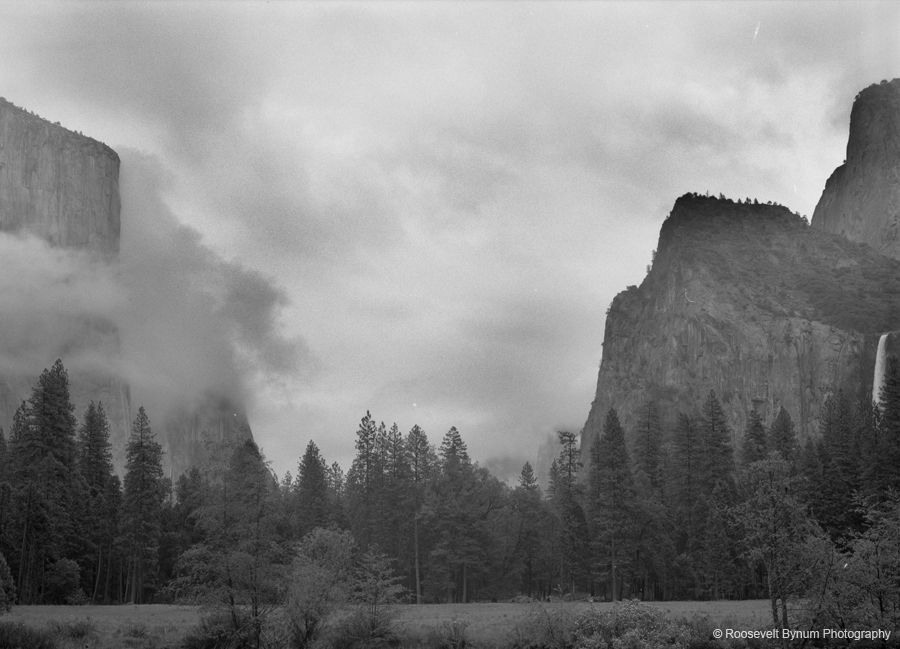
Yosemite Valley
Yosemite Valley under the clouds
-

Little Secret Falls
Little Secret Falls Kauai Hawaii
-
![Yosemite Valley #2]()
Yosemite Valley #2
-

The Moon is Full
The Full Moon taken with my telescope